Hydrography - OSM themes - continuous updating
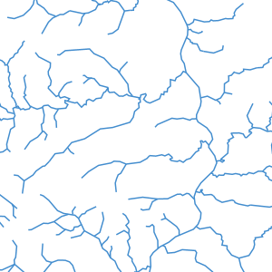
The OSM Hydrography theme includes two complementary layers:
- a layer (osm_fr_hydrographie_polygone in French, osm_en_water_polygon in English) containing all the polygonal objects of the selected territory bearing the OSM attributes natural=water, waterway=riverbank or the water key
- a layer (osm_fr_hydrographie_ligne in French, osm_en_waterway_line in English) containing all the linear objects of the chosen territory having the OSM waterway key
These two layers display in their attribute table the keys most commonly used in OSM for this theme, as well as a jsonb field containing all the OSM tags of the object.
They are continuously updated by LLg via imposm run from data extracts and minute replications provided by OSM France (the time lag with the main OSM server can be checked here: http://munin.openstreetmap.fr/osm14.openstreetmap.fr/download.vm.openstreetmap.fr/osm_replication_lag_osmbin.html )
Consult the parent sheet for more information, access to data on available areas or to other themes.
Simple
- Date (Revision)
- Presentation form
- Digital map
- Status
- On going
- Point of contact
-
Organisation name Individual name Electronic mail address Role Les Libres Géographes
Séverin Ménard
Point of contact
- Maintenance and update frequency
- Daily
- Keywords
-
-
LLg
-
waterway
-
river
-
stream
-
- Theme
-
-
Les Libres Géographes
-
OSM
-
OpenStreetMap
-
open data
-
-
GEMET
-
-
river channelling
-
surface water
-
-
INSPIRE themes
-
-
Meteorological geographical features
-
- Access constraints
- License
- Use constraints
- License
- Other constraints
-
ODbL License - map data © OpenStreetMap contributors
- Spatial representation type
- Vector
- Denominator
- 5000
- Language
- Français
- Character set
- UTF8
- Topic category
-
- Inland waters
))
- Reference system identifier
- EPSG3857
- Distribution format
-
Name Version
- Hierarchy level
- Dataset
Metadata
- File identifier
- ddabf8bc-1e97-4786-99f1-578f92071bb3 XML
- Metadata language
- Français
- Character set
- UTF8
- Date stamp
- 2024-11-12T13:52:22.614667305Z
- Metadata standard name
-
ISO 19115:2003/19139
- Metadata standard version
-
1.0
- Metadata author
-
Organisation name Individual name Electronic mail address Role Les Libres Géographes
Séverin Ménard
Point of contact
- Other language
-
Language Character encoding English UTF8 French UTF8
Overviews
Spatial extent
Provided by
