OSM latest continuous updating in EN and FR by LLg - French-speaking southern countries - parent sheet
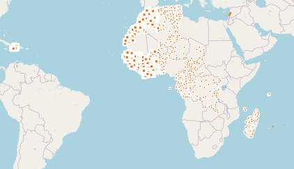
LLg makes available in the IFL OpenStreetMap thematic datasets for 28 French-speaking countries of the South (those listed in https://fr.wikipedia.org/wiki/Afrique_francophone + Mauritius, Lebanon and Haiti ), either with their original attributes ("tags"), mostly in English, or in a version in which more than 1400 categorised attributes are translated into French from existing translations in the OSM wiki and JOSM editor. The list of translated tags can be found here: https://gitlab.com/leslibresgeographes/osm-tags-translation/-/blob/main/LLG_OSM_SQL_translation_EN_FR_GitLab.tsv
These two datasets each represent 17 layers covering 8 different themes, as well as a "Planet" theme grouping all OSM objects on the territory in order to recreate its own themes. Each theme is presented in the "composed of" section below. The attribute table for each theme presents both the most common OSM keys and an jsonb field containing all the attributes of each object.
---------------------------------------------------
These OpenStreetMap datasets are continuously updated via imposm from data extracts and minute replications provided by OSM France (the time lag with the main OSM server can be checked here: http://munin.openstreetmap.fr/osm14.openstreetmap.fr/download.vm.openstreetmap.fr/osm_replication_lag_osmbin.html )
---------------------------------------------------
To access the data, scroll down to the “composed of” section and open the country file to download the desired theme(s):
- either directly from the country sheet, the entire territory in one of the available formats
- or from a MapStore context, on a part of the territory to be drawn by yourself or chosen within the administrative boundaries of the country in question. Demonstration videos are available here: https://llg-collabora.ethibox.fr/s/owY8DQTQpgDr8sw
Simple
- Date (Publication)
- Presentation form
- Digital document
- Status
- On going
- Point of contact
-
Organisation name Individual name Electronic mail address Role Les Libres Géographes
Séverin Ménard
Custodian
- Maintenance and update frequency
- Continual
- Theme
-
-
OpenStreetMap
-
open data
-
- Place
-
-
World
-
-
Continents, countries, sea regions of the world.
-
-
Benin
-
Algeria
-
Burkina Faso
-
Central African Republic
-
Republic of Congo
-
Democratic Republic of the Congo
-
Cameroon
-
Burundi
-
Comoros
-
Gabon
-
Djibouti
-
Equatorial Guinea
-
Guinea
-
Haiti
-
Côte d'Ivoire
-
Mali
-
Madagascar
-
Morocco
-
Niger
-
Mauritania
-
Senegal
-
Rwanda
-
Chad
-
Seychelles
-
Togo
-
Tunisia
-
- Access constraints
- License
- Use constraints
- License
- Other constraints
-
ODbL License - map data © OpenStreetMap contributors
- Spatial representation type
- Vector
- Denominator
- 5000
- Language
- eng, fr
- Character set
- UTF8
- Topic category
-
- Boundaries
- Farming
- Economy
- Environment
- Health
- Imagery base maps earth cover
- Inland waters
- Location
- Society
- Structure
- Transportation
- Utilities communication
))
- Reference system identifier
- EPSG3857
Metadata
- File identifier
- c5565c37-7692-4ab3-8286-3c3f9b2834ed XML
- Metadata language
- Français
- Character set
- UTF8
- Date stamp
- 2024-11-19T18:33:55.097593232Z
- Metadata standard name
-
ISO 19115:2003/19139
- Metadata standard version
-
1.0
- Metadata author
-
Organisation name Individual name Electronic mail address Role Les Libres Géographes
Séverin Ménard
Point of contact
- Other language
-
Language Character encoding English UTF8 French UTF8
Overviews
Spatial extent
Provided by
