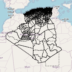
Algeria - OSM country - continuous updating
Country-wide download point and map for partial extraction of OSM thematic layers, available in the original English version or translated into French (for example, amenity=college and craft=joiner become equipement=enseignement supérieur et artisanat=menuisier), and continuously updated via imposm from data extracts and minute replications provided by OSM France (the time lag with the main OSM server can be checked here: http://munin.openstreetmap.fr/osm14.openstreetmap.fr/download.vm.openstreetmap.fr/osm_replication_lag_osmbin.html )
There are two ways to download the data:
- either the entire territory in one of the formats available via the WFS point "OSM EN and FR thematic layers for the whole country" below
- or on a part of the territory to be drawn by yourself or to be chosen within the administrative boundaries of the country in question, by clicking on the link "Display map and full or partial extraction in EN or FR" to access from a MapStore context over the country. Demonstration videos are available here: https://llg-collabora.ethibox.fr/s/owY8DQTQpgDr8sw
Currently, GEOPACKAGE FORMAT IS NOT FUNCTIONAL (the resulting layers are empty): prefer geojson format to retrieve all field names and convert them to geopackage from QGIS.
For further information on this LLg download point, please consult the parent metadata sheet linked at the bottom of this page, which also leads to child sheets presenting each theme offered.
Simple
- Date (Publication)
- Presentation form
- Digital map
- Status
- On going
- Point of contact
-
Organisation name Individual name Electronic mail address Role Les Libres Géographes
Séverin Ménard
Custodian
- Maintenance and update frequency
- Continual
- Keywords
-
-
LLg
-
- Place
-
-
Les Libres Géographes
-
OSM
-
OpenStreetMap
-
open data
-
Algeria
-
DZ
-
-
GEMET
-
-
Africa
-
agroforestry
-
agricultural building
-
agriculture
-
airport
-
agroindustry
-
energy supply
-
agricultural management
-
surface water
-
agricultural economics
-
temperate forest
-
thermal power plant
-
agriculture and cattle industry
-
waste sorting unit
-
agricultural exploitation
-
access road
-
marsh
-
tertiary sector
-
agricultural landscape
-
telecommunications
-
administration
-
territory
-
terrestrial area
-
abandoned industrial site
-
agricultural land
-
administrative jurisdiction
-
-
INSPIRE themes
-
-
Habitats and biotopes
-
Meteorological geographical features
-
Hydrography
-
Land cover
-
Administrative units
-
Geographical names
-
Transport networks
-
Production and industrial facilities
-
Geographical grid systems
-
Land use
-
Buildings
-
Utility and governmental services
-
Human health and safety
-
Agricultural and aquaculture facilities
-
-
Continents, countries, sea regions of the world.
-
-
Africa
-
Algeria
-
- Access constraints
- License
- Use constraints
- License
- Other constraints
-
ODbL License - map data © OpenStreetMap contributors
- Spatial representation type
- Vector
- Denominator
- 5000
- Language
- Français
- Character set
- UTF8
- Topic category
-
- Boundaries
- Farming
- Economy
- Environment
- Health
- Imagery base maps earth cover
- Inland waters
- Location
- Society
- Structure
- Transportation
- Utilities communication
))
- Reference system identifier
- EPSG3857
- Distribution format
-
Name Version gpkg
shp
dxf
json
csv
xls
kml
- OnLine resource
-
Protocol Linkage Name OGC:WFS-1.0.0-http-get-capabilities https://ifl2.francophonelibre.org/geoserver/OSM_DZ/wfs?SERVICE=WFS OSM EN and FR thematic layers for the whole country
WWW:LINK-1.0-http--link
https://ifl2.francophonelibre.org/mapstore/#/context/OSM_latest_LLg/460 Display map and full or partial extraction in EN or FR
- Hierarchy level
- Dataset
Metadata
- File identifier
- c5c4f3d3-87b4-42fa-bbc0-c7c66f254bef XML
- Metadata language
- Français
- Character set
- UTF8
- Date stamp
- 2024-11-15T18:56:33.545639725Z
- Metadata standard name
-
ISO 19115:2003/19139
- Metadata standard version
-
1.0
- Metadata author
-
Organisation name Individual name Electronic mail address Role Les Libres Géographes
Séverin Ménard
Point of contact
- Other language
-
Language Character encoding English UTF8 French UTF8
Overviews
Spatial extent
Provided by
