OSM latest mise à jour continue en EN et FR par LLg - pays francophones du sud - fiche parent
OSM latest continuous updating in EN and FR by LLg - French-speaking southern countries - parent sheet
LLg met à disposition dans l'IFL des jeux de données thématiques OpenStreetMap sur 28 pays francophones du Sud (ceux listés dans https://fr.wikipedia.org/wiki/Afrique_francophone + Maurice, le Liban et Haïti ), disponibles soit avec leurs attributs (« tags ») d'origine, pour la plupart en anglais, soit dans une version où plus de 1400 attributs catégorisés sont traduits en français, à partir des traductions existantes dans le wiki OSM et l'éditeur JOSM. La liste des attributs traduits est accessible ici : https://gitlab.com/leslibresgeographes/osm-tags-translation/-/blob/main/LLG_OSM_SQL_translation_EN_FR_GitLab.tsv
Ces deux ensembles de jeux de données représentent chacun 17 couches couvrant 8 différentes thématiques ainsi qu'une thématique dite « Planet » regroupant tous les objets OSM sur le territoire afin de recréer ses propres thématiques. Chaque thématique est présentée dans les fiches listées ci-dessous dans la rubrique « Composé de ». La table attributaire de chaque thématique présente à la fois les clés OSM les plus courantes ainsi qu'un champ jsonb contenant tous les attributs de chaque objet.
---------------------------------------------------
Ces jeux de jeux de données OpenStreetMap sont mis à jour en continu via imposm run à partir des extraits et des réplications minute fournies par OpenStreetMap France, puis les couches sont traduites en français (le décalage avec le serveur principal OSM peut être vérifié ici : http://munin.openstreetmap.fr/osm14.openstreetmap.fr/download.vm.openstreetmap.fr/osm_replication_lag_osmbin.html ).
---------------------------------------------------
Pour accéder aux données, descendre en bas de cette fiche jusqu'à la rubrique « Composé de » et ouvrir la fiche du pays choisi pour y télécharger la ou les thématiques désirées :
- soit directement depuis la fiche sur le pays, pour le territoire entier dans l'un des formats disponibles
- soit depuis un contexte MapStore, sur une partie du territoire à dessiner soi-même ou à choisir au sein des limites administratives du pays en question. Des vidéos de démonstration sont disponibles ici : https://llg-collabora.ethibox.fr/s/owY8DQTQpgDr8sw
LLg makes available in the IFL OpenStreetMap thematic datasets for 28 French-speaking countries of the South (those listed in https://fr.wikipedia.org/wiki/Afrique_francophone + Mauritius, Lebanon and Haiti ), either with their original attributes ("tags"), mostly in English, or in a version in which more than 1400 categorised attributes are translated into French from existing translations in the OSM wiki and JOSM editor. The list of translated tags can be found here: https://gitlab.com/leslibresgeographes/osm-tags-translation/-/blob/main/LLG_OSM_SQL_translation_EN_FR_GitLab.tsv
These two datasets each represent 17 layers covering 8 different themes, as well as a "Planet" theme grouping all OSM objects on the territory in order to recreate its own themes. Each theme is presented in the "composed of" section below. The attribute table for each theme presents both the most common OSM keys and an jsonb field containing all the attributes of each object.
---------------------------------------------------
These OpenStreetMap datasets are continuously updated via imposm from data extracts and minute replications provided by OSM France (the time lag with the main OSM server can be checked here: http://munin.openstreetmap.fr/osm14.openstreetmap.fr/download.vm.openstreetmap.fr/osm_replication_lag_osmbin.html )
---------------------------------------------------
To access the data, scroll down to the “composed of” section and open the country file to download the desired theme(s):
- either directly from the country sheet, the entire territory in one of the available formats
- or from a MapStore context, on a part of the territory to be drawn by yourself or chosen within the administrative boundaries of the country in question. Demonstration videos are available here: https://llg-collabora.ethibox.fr/s/owY8DQTQpgDr8sw
Simple
-
Date (Publication)Date (Publication)
-
Presentation formForme de la présentation
-
Digital documentDocument numérique
-
StatusEtat
-
On goingMise à jour continue
- Point of contact
-
Organisation name Individual name Electronic mail address Role Les Libres Géographes
Les Libres Géographes
Séverin Ménard
Séverin Ménard
CustodianGestionnaire
-
Maintenance and update frequencyFréquence de mise à jour
-
ContinualContinue
-
ThemeThème
-
-
OpenStreetMap
OpenStreetMap
-
open data
open data
-
-
PlaceLocalisation
-
-
World
World
-
-
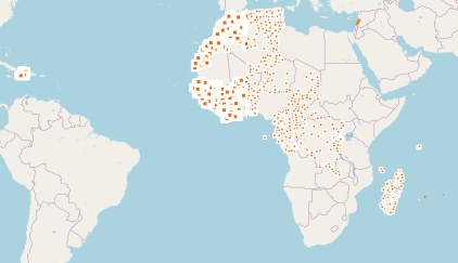
Continents, countries, sea regions of the world.
-
-
Benin
Benin
-
Algeria
Algeria
-
Burkina Faso
Burkina Faso
-
Central African Republic
Central African Republic
-
Republic of Congo
Republic of Congo
-
Democratic Republic of the Congo
Democratic Republic of the Congo
-
Cameroon
Cameroon
-
Burundi
Burundi
-
Comoros
Comoros
-
Gabon
Gabon
-
Djibouti
Djibouti
-
Equatorial Guinea
Equatorial Guinea
-
Guinea
Guinea
-
Haiti
Haiti
-
Côte d'Ivoire
Côte d'Ivoire
-
Mali
Mali
-
Madagascar
Madagascar
-
Morocco
Morocco
-
Niger
Niger
-
Mauritania
Mauritania
-
Senegal
Senegal
-
Rwanda
Rwanda
-
Chad
Chad
-
Seychelles
Seychelles
-
Togo
Togo
-
Tunisia
Tunisia
-
-
Access constraintsContraintes d'accès
-
LicenseLicence
-
Use constraintsContraintes d'utilisation
-
LicenseLicence
-
Autres contraintesOther constraints
-
Licence ODbL - données cartographiques © contributeurs et contributrices OpenStreetMap
ODbL License - map data © OpenStreetMap contributors
-
Spatial representation typeType de représentation spatiale
-
VectorVecteur
-
DenominatorDénominateur de l'échelle
- 5000
-
LanguageLangue de la ressource
- eng, fr
-
Character setEncodage des caractères
-
UTF8Utf8
-
Topic categoryCatégorie ISO
-
-
BoundariesLimites politiques et administratives
-
FarmingAgriculture
-
EconomyEconomie
-
EnvironmentEnvironnement
-
HealthSanté
-
Imagery base maps earth coverCarte de référence de la couverture terrestre
-
Inland watersEaux intérieures, Hydrographie
-
LocationLocalisation
-
SocietySociété
-
StructureConstructions et ouvrages
-
TransportationInfrastructures de transport
-
Utilities communicationTélécommunication, approvisionnement et énergie
-
))
-
Reference system identifierNom du système de référence
- EPSG3857EPSG3857
Metadata
-
File identifierIdentifiant de la fiche
- c5565c37-7692-4ab3-8286-3c3f9b2834ed XML
-
Metadata languageLangue
- Français
-
Character setJeu de caractères
-
UTF8Utf8
-
Date stampDate des métadonnées
- 2024-11-19T18:33:55.097593232Z
- Metadata standard name
-
ISO 19115:2003/19139
- Metadata standard version
-
1.0
- Metadata author
-
Organisation name Individual name Electronic mail address Role Les Libres Géographes
Les Libres Géographes
Séverin Ménard
Séverin Ménard
Point of contactPoint de contact
- Other language
-
Language Character encoding EnglishAnglaisUTF8Utf8FrenchFrançaisUTF8Utf8
Overviews
Spatial extent
Provided by
