Centrafrique - OSM pays - mise à jour continue
Central African Republic - OSM country - continuous updating
Point de téléchargement sur le pays entier et carte d'extraction partielle de couches thématiques OSM, disponibles dans l'anglais d'origine ou traduites en français (par exemple, amenity=college et craft=joiner deviennent equipement=enseignement supérieur et artisanat=menuisier), et mises à jour en continu via imposm à partir des extraits et réplication minute fournis par OSM France (le décalage avec le serveur principal OSM peut être vérifié ici : http://munin.openstreetmap.fr/osm14.openstreetmap.fr/download.vm.openstreetmap.fr/osm_replication_lag_osmbin.html ).
Pour télécharger les données, deux possibilités :
- soit le territoire entier dans l'un des formats disponibles via le point WFS « Couches thématiques OSM EN et FR sur l'ensemble du pays » ci-dessous
- soit sur une partie du territoire à dessiner soi-même ou à choisir au sein des limites administratives du pays en question, en cliquant sur le lien « Carte de visualisation et extraction complète ou partielle en EN ou FR » pour accéder à depuis un contexte MapStore sur le pays. Des vidéos de démonstration sont disponibles ici : https://llg-collabora.ethibox.fr/s/owY8DQTQpgDr8sw
Actuellement, LE FORMAT GEOPACKAGE N'EST PAS FONCTIONNEL (les couches obtenues sont presque vides de leurs attributs) : préférer le format geojson pour récupérer l’intégralité des noms des champs et le convertir en geopackage depuis QGIS.
Pour plus d'informations sur ce point de téléchargement LLg, consulter la fiche de métadonnées parent en lien au bas de cette fiche, qui mène également à des fiches enfants qui présentent chaque thématique proposée.
Country-wide download point and map for partial extraction of OSM thematic layers, available in the original English version or translated into French (for example, amenity=college and craft=joiner become equipement=enseignement supérieur et artisanat=menuisier), and continuously updated via imposm from data extracts and minute replications provided by OSM France (the time lag with the main OSM server can be checked here: http://munin.openstreetmap.fr/osm14.openstreetmap.fr/download.vm.openstreetmap.fr/osm_replication_lag_osmbin.html )
There are two ways to download the data:
- either the entire territory in one of the formats available via the WFS point "OSM EN and FR thematic layers for the whole country" below
- or on a part of the territory to be drawn by yourself or to be chosen within the administrative boundaries of the country in question, by clicking on the link "Display map and full or partial extraction in EN or FR" to access from a MapStore context over the country. Demonstration videos are available here: https://llg-collabora.ethibox.fr/s/owY8DQTQpgDr8sw
Currently, GEOPACKAGE FORMAT IS NOT FUNCTIONAL (the resulting layers are empty): prefer geojson format to retrieve all field names and convert them to geopackage from QGIS.
For further information on this LLg download point, please consult the parent metadata sheet linked at the bottom of this page, which also leads to child sheets presenting each theme offered.
Simple
-
Date (Publication)Date (Publication)
-
Presentation formForme de la présentation
-
Digital mapCarte numérique
-
StatusEtat
-
On goingMise à jour continue
- Point of contact
-
Organisation name Individual name Electronic mail address Role Les Libres Géographes
Les Libres Géographes
Séverin Ménard
Séverin Ménard
CustodianGestionnaire
-
Maintenance and update frequencyFréquence de mise à jour
-
DailyJournalière
- Keywords
-
-
LLg
LLg
-
-
PlaceLocalisation
-
-
Les Libres Géographes
Les Libres Géographes
-
OSM
OSM
-
OpenStreetMap
OpenStreetMap
-
open data
open data
-
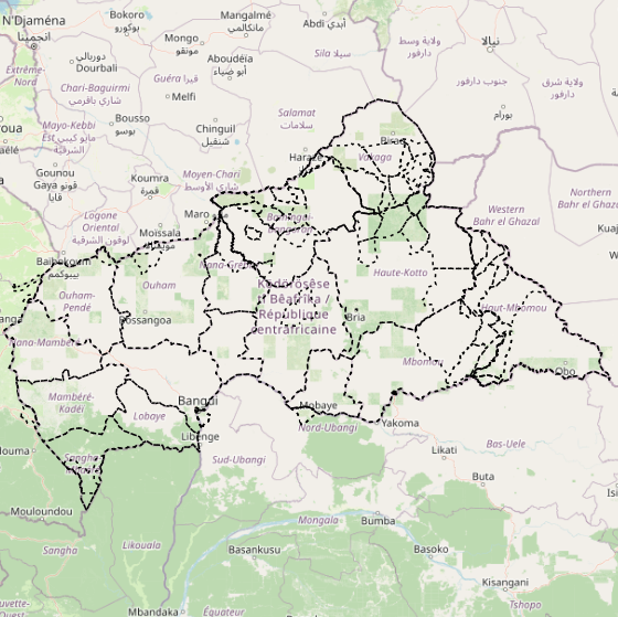
Centrafique
Central African Republic
-
République Centrafricaine
Central African Republic
-
-
GEMET
-
-
Afrique
Africa
-
agro-foresterie
agroforestry
-
aéroport
airport
-
bâtiment agricole
agricultural building
-
agriculture
agriculture
-
approvisionnement en énergie
energy supply
-
agroindustrie
agroindustry
-
eau de surface
surface water
-
gestion agricole
agricultural management
-
forêt des zones tempérées
temperate forest
-
centrale thermique
thermal power plant
-
centre de tri (déchets)
waste sorting unit
-
economie agricole
agricultural economics
-
juridiction administrative
administrative jurisdiction
-
agriculture et élevage industriel
agriculture and cattle industry
-
exploitation agricole
agricultural exploitation
-
marais
marsh
-
route d'accès
access road
-
secteur tertiaire
tertiary sector
-
paysage cultivé
agricultural landscape
-
télécommunication
telecommunications
-
territoire
territory
-
administration
administration
-
site abandonné
abandoned industrial site
-
zone terrestre
terrestrial area
-
terre agricole
agricultural land
-
-
INSPIRE themes
-
-
Habitats et biotopes
Habitats and biotopes
-
Hydrographie
Hydrography
-
Caractéristiques géographiques météorologiques
Meteorological geographical features
-
Unités administratives
Administrative units
-
Occupation des terres
Land cover
-
Dénominations géographiques
Geographical names
-
Réseaux de transport
Transport networks
-
Systèmes de maillage géographique
Geographical grid systems
-
Usage des sols
Land use
-
Bâtiments
Buildings
-
Santé et sécurité des personnes
Human health and safety
-
Lieux de production et sites industriels
Production and industrial facilities
-
Services d'utilité publique et services publics
Utility and governmental services
-
Installations agricoles et aquacoles
Agricultural and aquaculture facilities
-
-
Continents, countries, sea regions of the world.
-
-
Africa
Africa
-
Central African Republic
Central African Republic
-
-
Access constraintsContraintes d'accès
-
LicenseLicence
-
Use constraintsContraintes d'utilisation
-
LicenseLicence
-
Autres contraintesOther constraints
-
Licence ODbL - données cartographiques © contributeurs et contributrices OpenStreetMap
ODbL License - map data © OpenStreetMap contributors
-
Spatial representation typeType de représentation spatiale
-
VectorVecteur
-
DenominatorDénominateur de l'échelle
- 5000
-
LanguageLangue de la ressource
- Français
-
Character setEncodage des caractères
-
UTF8Utf8
-
Topic categoryCatégorie ISO
-
-
BoundariesLimites politiques et administratives
-
FarmingAgriculture
-
EconomyEconomie
-
EnvironmentEnvironnement
-
HealthSanté
-
Imagery base maps earth coverCarte de référence de la couverture terrestre
-
Inland watersEaux intérieures, Hydrographie
-
LocationLocalisation
-
SocietySociété
-
StructureConstructions et ouvrages
-
TransportationInfrastructures de transport
-
Utilities communicationTélécommunication, approvisionnement et énergie
-
))
-
Reference system identifierNom du système de référence
- EPSG3857EPSG3857
- Distribution format
-
Name Version gpkg
gpkg
shp
shp
dxf
dxf
json
json
csv
csv
xls
xls
kml
kml
- OnLine resource
-
Protocol Linkage Name OGC:WFS-1.0.0-http-get-capabilities https://ifl2.francophonelibre.org/geoserver/OSM_CF/wfs?SERVICE=WFS Couches thématiques OSM EN et FR pour l'ensemble du pays
OSM EN and FR thematic layers for the whole country
WWW:LINK-1.0-http--link
https://ifl2.francophonelibre.org/mapstore/#/context/OSM_latest_LLg/161 Carte de visualisation et extraction complète ou partielle en EN ou FR
Display map and full or partial extraction in EN or FR
-
Hierarchy levelNiveau
-
DatasetJeu de données
Metadata
-
File identifierIdentifiant de la fiche
- c18325bc-f1a2-4657-9150-8ad5900a6686 XML
-
Metadata languageLangue
- Français
-
Character setJeu de caractères
-
UTF8Utf8
-
Date stampDate des métadonnées
- 2024-11-12T14:03:17.524077199Z
- Metadata standard name
-
ISO 19115:2003/19139
- Metadata standard version
-
1.0
- Metadata author
-
Organisation name Individual name Electronic mail address Role Les Libres Géographes
Les Libres Géographes
Séverin Ménard
Séverin Ménard
Point of contactPoint de contact
- Other language
-
Language Character encoding EnglishAnglaisUTF8Utf8FrenchFrançaisUTF8Utf8
Overviews
Spatial extent
Provided by
