Édifices - thématique OSM - mise à jour continue
Buildings - OSM themes - continuous updating
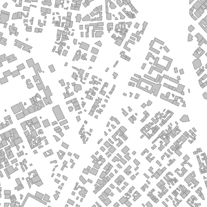
La thématique Édifices OSM comporte une seule couche (osm_fr_edifice en français, osm_en_building en anglais) contenant tous les objets polygonaux du territoire choisi portant la clé OSM building traduite en français par edifice.
Cette couche affiche dans sa table d'attributs les clés les plus couramment utilisées dans OSM sur cette thématique (noms, adressage, type, matériaux de construction, toiture, etc.), ainsi qu'un champ jsonb contenant l'ensemble des attributs OSM de l'objet.
Elle est mise à jour en continu par LLg via imposm run à partir des extraits et réplication minute fournis par OSM France (le décalage avec le serveur principal OSM peut être vérifié ici : http://munin.openstreetmap.fr/osm14.openstreetmap.fr/download.vm.openstreetmap.fr/osm_replication_lag_osmbin.html ).
Un champ (added_at en anglais, ajoute_a en français) indique la date et l’heure à laquelle l’objet a été ajouté dans la base de l’IFL (à ne pas confondre avec le timestamp OSM, qui ne fait pas partie des attributs de la couche) et un champ (added_by en anglais, ajoute_par en français) si la donnée a été ajoutée via l’import de l’extrait (valeur « imposm import ») ou via les mises à jour en continu (valeur « imposm update »).
Consulter la fiche parente pour disposer de plus d'information, accéder aux données sur les zones disponibles ou aux autres thématiques.
The OSM Buildings theme has a single layer (osm_fr_edifice in French, osm_en_building in English) containing all the polygonal objects in the selected territory having the OSM building key translated into French by edifice.
This layer displays in its attribute table the most commonly used keys in OSM for this theme (names, address, type, construction materials, roofing, etc.), as well as an jsonb field containing all the OSM tags of the object.
It is continuously updated by LLg via imposm run from data extracts and minute replications provided by OSM France (the time lag with the main OSM server can be checked here: http://munin.openstreetmap.fr/osm14.openstreetmap.fr/download.vm.openstreetmap.fr/osm_replication_lag_osmbin.html )
A field (added_at in English or ajoute_a in French) indicates the date and time at which the object was added to the IFL database (not to be confused with the OSM timestamp, which is not included in the layer attributes) and a field (added_by in English or ajoute_par in French) indicates whether the data was added via the import of the extract (‘imposm import’ value) or via continuous updates (‘imposm update’ value).
Consult the parent sheet for more information, access to data on available areas or to other themes.
Simple
-
Date (Revision)Date (Révision)
-
Presentation formForme de la présentation
-
Digital mapCarte numérique
-
StatusEtat
-
On goingMise à jour continue
- Point of contact
-
Organisation name Individual name Electronic mail address Role Les Libres Géographes
Les Libres Géographes
Séverin Ménard
Séverin Ménard
Point of contactPoint de contact
-
Maintenance and update frequencyFréquence de mise à jour
-
DailyJournalière
- Keywords
-
-
LLg
LLg
-
édifice
edifice
-
bâtiment
building
-
-
ThemeThème
-
-
Les Libres Géographes
Les Libres Géographes
-
OSM
OSM
-
OpenStreetMap
OpenStreetMap
-
open data
open data
-
-
GEMET
-
-
Afrique
Africa
-
bâtiment agricole
agricultural building
-
-
INSPIRE themes
-
-
Bâtiments
Buildings
-
-
Continents, countries, sea regions of the world.
-
-
Africa
Africa
-
-
Access constraintsContraintes d'accès
-
LicenseLicence
-
Use constraintsContraintes d'utilisation
-
LicenseLicence
-
Autres contraintesOther constraints
-
Licence ODbL - données cartographiques © contributeurs et contributrices OpenStreetMap
ODbL License - map data © OpenStreetMap contributors
-
Spatial representation typeType de représentation spatiale
-
VectorVecteur
-
DenominatorDénominateur de l'échelle
- 5000
-
LanguageLangue de la ressource
- Français
-
Character setEncodage des caractères
-
UTF8Utf8
-
Topic categoryCatégorie ISO
-
-
StructureConstructions et ouvrages
-
))
-
Reference system identifierNom du système de référence
- EPSG3857EPSG3857
- Distribution format
-
Name Version
-
Hierarchy levelNiveau
-
DatasetJeu de données
Metadata
-
File identifierIdentifiant de la fiche
- 82269c8d-0bbb-4176-a93f-e2ed1ccdfdaa XML
-
Metadata languageLangue
- Français
-
Character setJeu de caractères
-
UTF8Utf8
-
Date stampDate des métadonnées
- 2024-11-12T13:48:25.013219761Z
- Metadata standard name
-
ISO 19115:2003/19139
- Metadata standard version
-
1.0
- Metadata author
-
Organisation name Individual name Electronic mail address Role Les Libres Géographes
Les Libres Géographes
Séverin Ménard
Séverin Ménard
Point of contactPoint de contact
- Other language
-
Language Character encoding EnglishAnglaisUTF8Utf8FrenchFrançaisUTF8Utf8
Overviews
Spatial extent
Provided by
