Points d’Intérêt (POI) - thématique OSM - mise à jour continue
Points Of Interest (POI) - OSM themes - continuous updating
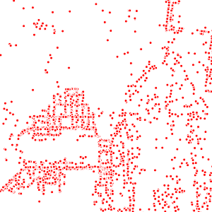
La thématique Points d’Intérêt (POI) OSM comporte deux couches complémentaires et une de synthèse :
- une couche (osm_fr_poi_point en français, osm_en_poi_point en anglais) contenant tous les objets ponctuels du territoire choisi portant les clés OSM amenity, craft, emergency, healthcare, healthcare:speciality, historic, leisure, man_made, military, office, power, pump, shop ou tourism, traduites en français par equipement, artisanat, urgences, sante_structure, sante_structure_type, historique, loisirs, structure_artificielle, militaire, bureau, energie, pompe, commerce et tourisme ;
- une couche (osm_fr_poi_plg en français, osm_en_poi_plg en anglais) contenant tous les objets polygonaux du territoire choisi portant les mêmes clés OSM que la couche précédente ;
- une couche (osm_fr_poi_tous en français, osm_en_poi_all en anglais) rassemblant les POI ponctuels et ceux originellement sous forme de polygones, mais dont la géométrie a été remplacée par un point à l'intérieur du polygone (fonction ST_PointOnSurface dans PostGIS).
Ces trois couches affichent dans leur table d'attributs les champs de noms les plus importants, ceux de l’adressage puis, classés par ordre alphabétique, des champs correspondant aux clés OSM les plus couramment utilisées sur cette thématique, ainsi qu'un champ jsonb contenant l'ensemble des attributs OSM de l'objet.
Elles sont mises à jour en continu par LLg via imposm run à partir des extraits et réplication minute fournis par OSM France (le décalage avec le serveur principal OSM peut être vérifié ici : http://munin.openstreetmap.fr/osm14.openstreetmap.fr/download.vm.openstreetmap.fr/osm_replication_lag_osmbin.html ).
Un champ (added_at en anglais, ajoute_a en français) indique la date et l’heure à laquelle l’objet a été ajouté dans la base de l’IFL (à ne pas confondre avec le timestamp OSM, qui ne fait pas partie des attributs de la couche) et un champ (added_by en anglais, ajoute_par en français) si la donnée a été ajoutée via l’import de l’extrait (valeur « imposm import ») ou via les mises à jour en continu (valeur « imposm update »).
Consulter la fiche parente pour disposer de plus d'information, accéder aux données sur les zones disponibles ou aux autres thématiques.
The OSM Points of Interest (POI) theme includes two complementary layers and a summary layer:
- a layer (osm_fr_poi_point in French, osm_en_poi_point in English) containing all the point objects in the selected territory bearing the OSM keys amenity, craft, emergency, healthcare, healthcare:speciality, historic, leisure, man_made, military, office, power, pump, shop or tourism, translated into French as equipement, artisanat, urgences, sante_structure, sante_structure_type, historique, loisirs, structure_artificielle, militaire, bureau, energie, pompe, commerce et tourisme;
- a layer (osm_fr_poi_plg in French, osm_en_poi_plg in English) containing all the polygonal objects of the selected territory with the same OSM keys as the previous layer;
- a layer (osm_fr_poi_tous in French, osm_en_poi_all in English) bringing together point POIs and those originally in the form of polygons, but whose geometry has been remapped to a point inside the polygon (ST_PointOnSurface function in PostGIS).
These three layers display in their attribute table the most important name fields, those of the addressing and then, classified in alphabetical order, fields corresponding to the most commonly used OSM keys for this theme, as well as a jsonb field containing all the OSM tags of the object.
They are continuously updated by LLg via imposm run from data extracts and minute replications provided by OSM France (the time lag with the main OSM server can be checked here: http://munin.openstreetmap.fr/osm14.openstreetmap.fr/download.vm.openstreetmap.fr/osm_replication_lag_osmbin.html )
A field (added_at in English or ajoute_a in French) indicates the date and time at which the object was added to the IFL database (not to be confused with the OSM timestamp, which is not included in the layer attributes) and a field (added_by in English or ajoute_par in French) indicates whether the data was added via the import of the extract (‘imposm import’ value) or via continuous updates (‘imposm update’ value).
Consult the parent sheet for more information, access to data on available areas or to other themes.
Simple
-
Date (Revision)Date (Révision)
-
Presentation formForme de la présentation
-
Digital mapCarte numérique
-
StatusEtat
-
On goingMise à jour continue
- Point of contact
-
Organisation name Individual name Electronic mail address Role Les Libres Géographes
Les Libres Géographes
Séverin Ménard
Séverin Ménard
Point of contactPoint de contact
-
Maintenance and update frequencyFréquence de mise à jour
-
DailyJournalière
- Keywords
-
-
LLg
LLg
-
POI
POI
-
Points d'intérêt
Points of Interest
-
équipement
amenity
-
commerces
shops
-
bureaux
offices
-
-
ThemeThème
-
-
Les Libres Géographes
Les Libres Géographes
-
OSM
OSM
-
OpenStreetMap
OpenStreetMap
-
open data
open data
-
-
GEMET
-
-
secteur tertiaire
tertiary sector
-
Afrique
Africa
-
-
INSPIRE themes
-
-
Santé et sécurité des personnes
Human health and safety
-
Services d'utilité publique et services publics
Utility and governmental services
-
-
Continents, countries, sea regions of the world.
-
-
Africa
Africa
-
-
Access constraintsContraintes d'accès
-
LicenseLicence
-
Use constraintsContraintes d'utilisation
-
LicenseLicence
-
Autres contraintesOther constraints
-
Licence ODbL - données cartographiques © contributeurs et contributrices OpenStreetMap
ODbL License - map data © OpenStreetMap contributors
-
Spatial representation typeType de représentation spatiale
-
VectorVecteur
-
DenominatorDénominateur de l'échelle
- 5000
-
LanguageLangue de la ressource
- Français
-
Character setEncodage des caractères
-
UTF8Utf8
-
Topic categoryCatégorie ISO
-
-
HealthSanté
-
LocationLocalisation
-
SocietySociété
-
StructureConstructions et ouvrages
-
Utilities communicationTélécommunication, approvisionnement et énergie
-
EconomyEconomie
-
))
-
Reference system identifierNom du système de référence
- EPSG3857EPSG3857
- Distribution format
-
Name Version
-
Hierarchy levelNiveau
-
DatasetJeu de données
Metadata
-
File identifierIdentifiant de la fiche
- 78962f3a-7a85-4f72-8b60-d74a81f681e0 XML
-
Metadata languageLangue
- Français
-
Character setJeu de caractères
-
UTF8Utf8
-
Date stampDate des métadonnées
- 2024-11-19T18:46:35.534890342Z
- Metadata standard name
-
ISO 19115:2003/19139
- Metadata standard version
-
1.0
- Metadata author
-
Organisation name Individual name Electronic mail address Role Les Libres Géographes
Les Libres Géographes
Séverin Ménard
Séverin Ménard
Point of contactPoint de contact
- Other language
-
Language Character encoding EnglishAnglaisUTF8Utf8FrenchFrançaisUTF8Utf8
Overviews
Spatial extent
Provided by
