Land cover - OSM themes - continuous updating
The OSM Land Cover theme includes a single layer (osm_fr_couverture_sol in French, osm_en_landcover in English) containing all the polygonal objects of the selected territory bearing the OSM attribute aeroway=aerodrome, place=island, place=islet, place=square or the OSM keys landuse, leisure and natural translated into French by aeroport=aerodrome, place=island, lieu=place dans une ville, usage_du_sol, loisirs and nature.
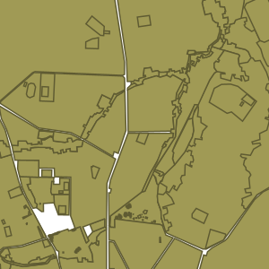
This layer displays in its attribute table the keys most commonly used in OSM for this theme, as well as a jsonb field containing all the OSM tags of the object.
It is continuously continuously updated by LLg via imposm run from data extracts and minute replications provided by OSM France (the time lag with the main OSM server can be checked here: http://munin.openstreetmap.fr/osm14.openstreetmap.fr/download.vm.openstreetmap.fr/osm_replication_lag_osmbin.html )
A field (added_at in English or ajoute_a in French) indicates the date and time at which the object was added to the IFL database (not to be confused with the OSM timestamp, which is not included in the layer attributes) and a field (added_by in English or ajoute_par in French) indicates whether the data was added via the import of the extract (‘imposm import’ value) or via continuous updates (‘imposm update’ value).
Consult the parent sheet for more information, access to data on available areas or to other themes.
Simple
- Date (Revision)
- Presentation form
- Digital map
- Status
- On going
- Point of contact
-
Organisation name Individual name Electronic mail address Role Les Libres Géographes
Séverin Ménard
Point of contact
- Maintenance and update frequency
- Daily
- Keywords
-
-
LLg
-
landcover
-
- Theme
-
-
Les Libres Géographes
-
OSM
-
OpenStreetMap
-
open data
-
-
GEMET
-
-
Africa
-
agriculture
-
agriculture and cattle industry
-
agroforestry
-
airport
-
agricultural ecology
-
agricultural economics
-
agroindustry
-
terrestrial ecosystem
-
agricultural exploitation
-
forest biological reserve
-
agricultural landscape
-
territory
-
agricultural land
-
terrestrial area
-
-
INSPIRE themes
-
-
Land cover
-
Bio-geographical regions
-
Land use
-
-
Continents, countries, sea regions of the world.
-
-
Africa
-
- Access constraints
- License
- Use constraints
- License
- Other constraints
-
ODbL License - map data © OpenStreetMap contributors
- Spatial representation type
- Vector
- Denominator
- 5000
- Language
- Français
- Character set
- UTF8
- Topic category
-
- Location
- Farming
- Environment
- Imagery base maps earth cover
))
- Reference system identifier
- EPSG3857
- Distribution format
-
Name Version
- Hierarchy level
- Dataset
Metadata
- File identifier
- 56d24035-a980-4edc-8f2d-921c14c0cf3d XML
- Metadata language
- Français
- Character set
- UTF8
- Date stamp
- 2024-11-12T14:06:53.469362549Z
- Metadata standard name
-
ISO 19115:2003/19139
- Metadata standard version
-
1.0
- Metadata author
-
Organisation name Individual name Electronic mail address Role Les Libres Géographes
Séverin Ménard
Point of contact
- Other language
-
Language Character encoding English UTF8 French UTF8
Overviews
Spatial extent
Provided by
