Planet - OSM toutes thématiques - mise à jour continue
Planet - OSM all themes - continuous updating
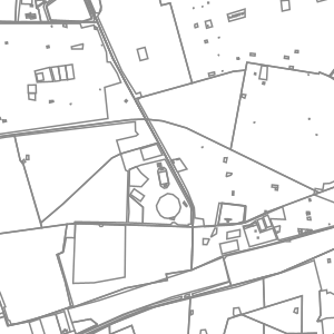
La thématique Planet OSM comporte trois couches complémentaires :
- une couche (osm_fr_planet_point en français, osm_en_planet_point en anglais) contenant tous les objets ponctuels OSM du territoire choisi
- une couche (osm_fr_planet_ligne en français, osm_en_planet_line en anglais) contenant tous les objets linéaires du territoire choisi
- une couche (osm_fr_planet_polygone_sans_batiments en français, osm_en_planet_polygon_no_building en anglais) contenant tous les objets polygonaux du territoire choisi, sauf tous ceux comportant la clé OSM building, afin de limiter sa taille
Ces trois couches affichent dans leur table d'attributs les champs de noms les plus importants, l’adressage, puis classés par ordre alphabétique, une cinquantaine de champs correspondant aux clés OSM les plus couramment utilisées sur cette thématique, ainsi qu'un champ jsonb contenant l'ensemble des attributs OSM de l'objet.
Elles sont mises à jour en continu par LLg via imposm run à partir des extraits et réplication minute fournis par OSM France (le décalage avec le serveur principal OSM peut être vérifié ici : http://munin.openstreetmap.fr/osm14.openstreetmap.fr/download.vm.openstreetmap.fr/osm_replication_lag_osmbin.html ).
Un champ (added_at en anglais, ajoute_a en français) indique la date et l’heure à laquelle l’objet a été ajouté dans la base de l’IFL (à ne pas confondre avec le timestamp OSM, qui ne fait pas partie des attributs de la couche) et un champ (added_by en anglais, ajoute_par en français) si la donnée a été ajoutée via l’import de l’extrait (valeur « imposm import ») ou via les mises à jour en continu (valeur « imposm update »).
Consulter la fiche parente pour disposer de plus d'information, accéder aux données sur les zones disponibles ou aux autres thématiques.
The OSM Planet theme includes three complementary layers:
- a layer (osm_fr_planet_point in French, osm_en_planet_point in English) containing all the OSM point objects of the chosen territory
- a layer (osm_fr_planet_ligne in French, osm_en_planet_line in English) containing all the linear objects of the selected territory
- a layer (osm_fr_planet_polygon_sans_batiments in French, osm_en_planet_polygon_no_building in English) containing all the polygonal objects of the selected territory, except those with the OSM building key, in order to limit its size.
These three layers display in their attribute table the most important name fields, the addressing, then classified in alphabetical order, about fifty fields corresponding to the most commonly used OSM keys on this theme, as well as a jsonb field containing all the OSM tags of the object.
They are continuously updated by LLg via imposm run from data extracts and minute replications provided by OSM France (the time lag with the main OSM server can be checked here: http://munin.openstreetmap.fr/osm14.openstreetmap.fr/download.vm.openstreetmap.fr/osm_replication_lag_osmbin.html )
A field (added_at in English or ajoute_a in French) indicates the date and time at which the object was added to the IFL database (not to be confused with the OSM timestamp, which is not included in the layer attributes) and a field (added_by in English or ajoute_par in French) indicates whether the data was added via the import of the extract (‘imposm import’ value) or via continuous updates (‘imposm update’ value).
Consult the parent page for more information, access to the data on available areas or to other themes.
Simple
-
Date (Revision)Date (Révision)
-
Presentation formForme de la présentation
-
Digital mapCarte numérique
-
StatusEtat
-
On goingMise à jour continue
- Point of contact
-
Organisation name Individual name Electronic mail address Role Les Libres Géographes
Les Libres Géographes
Séverin Ménard
Séverin Ménard
Point of contactPoint de contact
-
Maintenance and update frequencyFréquence de mise à jour
-
DailyJournalière
- Keywords
-
-
LLg
LLg
-
planet
planet
-
-
ThemeThème
-
-
Les Libres Géographes
Les Libres Géographes
-
OSM
OSM
-
OpenStreetMap
OpenStreetMap
-
open data
open data
-
-
GEMET
-
-
Afrique
Africa
-
-
INSPIRE themes
-
-
Adresses
Addresses
-
Bâtiments
Buildings
-
Lieux de production et sites industriels
Production and industrial facilities
-
Dénominations géographiques
Geographical names
-
Occupation des terres
Land cover
-
Santé et sécurité des personnes
Human health and safety
-
Réseaux de transport
Transport networks
-
Unités administratives
Administrative units
-
Services d'utilité publique et services publics
Utility and governmental services
-
Usage des sols
Land use
-
-
Continents, countries, sea regions of the world.
-
-
Africa
Africa
-
-
Access constraintsContraintes d'accès
-
LicenseLicence
-
Use constraintsContraintes d'utilisation
-
LicenseLicence
-
Autres contraintesOther constraints
-
Licence ODbL - données cartographiques © contributeurs et contributrices OpenStreetMap
ODbL License - map data © OpenStreetMap contributors
-
Spatial representation typeType de représentation spatiale
-
VectorVecteur
-
DenominatorDénominateur de l'échelle
- 5000
-
LanguageLangue de la ressource
- Français
-
Character setEncodage des caractères
-
UTF8Utf8
-
Topic categoryCatégorie ISO
-
-
LocationLocalisation
-
SocietySociété
-
FarmingAgriculture
-
BoundariesLimites politiques et administratives
-
EconomyEconomie
-
EnvironmentEnvironnement
-
HealthSanté
-
Imagery base maps earth coverCarte de référence de la couverture terrestre
-
Inland watersEaux intérieures, Hydrographie
-
StructureConstructions et ouvrages
-
TransportationInfrastructures de transport
-
Utilities communicationTélécommunication, approvisionnement et énergie
-
))
-
Reference system identifierNom du système de référence
- EPSG3857EPSG3857
- Distribution format
-
Name Version
-
Hierarchy levelNiveau
-
DatasetJeu de données
Metadata
-
File identifierIdentifiant de la fiche
- 2c9b30e4-66f8-4d55-af3f-1d2c3cd62f42 XML
-
Metadata languageLangue
- Français
-
Character setJeu de caractères
-
UTF8Utf8
-
Date stampDate des métadonnées
- 2024-11-12T14:08:08.779223627Z
- Metadata standard name
-
ISO 19115:2003/19139
- Metadata standard version
-
1.0
- Metadata author
-
Organisation name Individual name Electronic mail address Role Les Libres Géographes
Les Libres Géographes
Séverin Ménard
Séverin Ménard
Point of contactPoint de contact
- Other language
-
Language Character encoding EnglishAnglaisUTF8Utf8FrenchFrançaisUTF8Utf8
Overviews
Spatial extent
Provided by
