Projet COhéSIoN - données géographiques ouvertes - OSM
OSM Cohesion datasets
---
CohéSIoN is a research project on the "socio-territorial construction of inequalities: territorial diagnosis and decision support". It is being implemented in the city of Bouaké in Côte d'Ivoire from 2018 to 2021 by the Institut de Recherche pour le Développement (IRD) with the support of the Agence Nationale pour la Recherche (ANR).
The project's programmes of activities will be carried out by a research group comprising the IRD (MIVEGEC and ESPACE-DEV), Clark University, the Institut Pierre Richet (IPR), the Centre de Recherche pour le Développement (CRD), the Centre d'Entomologie Médicale et Vétérinaire (CEMV) and the French association Les Libres Géographes (LLG), members of the OSM project in Côte d'Ivoire, who are also members of the local OSM association (OSM-CI), as well as professors from the Université Félix Houphouët-Boigny (UFHB), the Université Alassane Ouattara (UAO) and researchers from the CIRAD Astre and IRD Résiliences laboratories. To find out more about the COhéSIoN project, visit https://anr.fr/Projet-ANR-17-CE22-0007
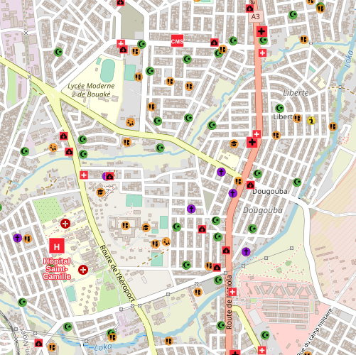
For 6 weeks between early April and mid-May 2018, LLG coordinated a comprehensive mapping of the city in OpenStreetMap on the following themes:
- Buildings, road network and land use zones on Digital Globe Premium Imagery using the JOSM editor
- Terrain mapping from the exterior (without entering the structures) of biomedical care structures, drug supply points, educational structures, places of worship, government services, markets and community water points. The mapping was carried out using the KoBoCollect, OsmAnd, OsmTracker and Mapillary applications.
In 2019, the data was corrected using the Osmose service ( http://osmose.openstreetmap.fr ) and updated using Maxar imagery.
The thematic data layers produced are extracted daily using imposm from the .pbf file for Côte d'Ivoire provided by GeoFabrik. Some layers also undergo additional processing using pgsql, as specified in their metadata sheet.
The following are available:
* Child metadata sheets for each project theme, including download points in GeoPackage, Shapefile and GeoJSON formats.
* MapStore and Mapfishapp inventory and observatory maps for the Biomedical and Education themes.
Simple
- Date (Publication)
- Citation identifier
-
https://ifl.francophonelibre.org/geonetwork/srv/fre/catalog.search#/metadata/e11a9f4e-369b-4dbb-a34d-2133fbe3f9d2
- Presentation form
- Digital map
- Status
- Completed
- Point of contact
-
Organisation name Individual name Electronic mail address Role Les Libres Géographes
Séverin Ménard
Point of contact
- Maintenance and update frequency
- Irregular
- Metadata author
-
Organisation name Individual name Electronic mail address Role Les Libres Géographes
Séverin Ménard
Publisher
- Theme
-
-
LLG
-
Les Libres Géographes
-
IRD
-
COhéSIoN
-
- Place
-
-
Ivory Coast
-
Bouaké
-
- Keywords
-
- Access constraints
- License
- Use constraints
- License
- Other constraints
-
ODbL
- Spatial representation type
- Vector
- Denominator
- 1000
- Language
- Français
- Character set
- UTF8
- Topic category
-
- Health
- Farming
- Boundaries
- Environment
- Imagery base maps earth cover
- Inland waters
- Location
- Society
- Transportation
- Structure
- Utilities communication
- Elevation
- Begin date
- 2018-04-01
- End date
- 2022-05-10
))
- Reference system identifier
- WGS 1984
- Distribution format
-
Name Version
- OnLine resource
- Hierarchy level
- Dataset
- Statement
-
Données collectées sur le terrain en 2018 à l'aide des applis Android OsmAnd et KoBoToolbox, puis éditées avec l'éditeur JOSM.
Metadata
- File identifier
- e11a9f4e-369b-4dbb-a34d-2133fbe3f9d2 XML
- Metadata language
- Français
- Character set
- UTF8
- Date stamp
- 2024-06-18T22:20:44
- Metadata standard name
-
ISO 19115:2003/19139
- Metadata standard version
-
1.0
- Metadata author
-
Organisation name Individual name Electronic mail address Role Les Libres Géographes
Séverin Ménard
Point of contact
- Dataset URI
- Other language
-
Language Character encoding English UTF8 French UTF8
Overviews
Spatial extent
Provided by
