hameaux - Beanantsindra - observations sur terrain GRET/IRD - projet Rhyvière - GRET/IRD
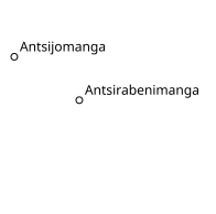
Ce jeu de données vectorielles ponctuelles décrit les hameaux de la zone de Beanantsindra à Madagascar. Il comprend 6 objets et fait partie du volet Environnement du projet Rhyvière mis en œuvre par l'ONG Gret. Il a été créé en 2015 par GRET/IRD à partir des sources suivantes : observations sur terrain GRET/IRD.
Simple
- Date (Publication)
- 2021-11-25
- Date (Creation)
- 2015
- Presentation form
- Digital document
- Status
- Completed
- Point of contact
-
Organisation name Individual name Electronic mail address Role Les Libres Géographes
Séverin Ménard
Point of contact Les Libres Géographes
Nicolas Chavent
Point of contact
- Maintenance and update frequency
- Not planned
- Keywords
-
-
LLG
-
- Keywords
-
-
Les Libres Géographes
-
-
GEMET
-
-
village
-
-
Continents, countries, sea regions of the world.
-
-
Madagascar
-
-
Rhyvière - Madagascar - Gret
-
-
Direction Régionale de l’Environnement et du Développement Durable
-
DREDD
-
Fonds Français pour l'Environnement Mondial
-
FFEM
-
LLg
-
Gret
-
OSM_Mg
-
Union européenne
-
schéma d'aménagement
-
Les Libres Géographes
-
Rhyvière
-
Beanantsindra
-
environnement
-
-
INSPIRE themes
-
-
Addresses
-
- Access constraints
- License
- Use constraints
- License
- Other constraints
-
A déterminer
- Spatial representation type
- Vector
- Language
- Français
- Topic category
-
- Location
))
- Reference system identifier
- WGS 1984
- OnLine resource
- Hierarchy level
- Dataset
Metadata
- File identifier
- 7357dc67-9cb6-42f3-a21f-5d7e6850d646 XML
- Metadata language
- Français
- Character set
- UTF8
- Date stamp
- 2025-03-14T19:36:40.892890081Z
- Metadata standard name
-
ISO 19115:2003/19139
- Metadata standard version
-
1.0
- Metadata author
-
Organisation name Individual name Electronic mail address Role Les Libres Géographes
Séverin Ménard
Point of contact Les Libres Géographes
Nicolas Chavent
Point of contact
- Other language
-
Language Character encoding Malagasy UTF8 English UTF8 French UTF8
Overviews

Spatial extent
Provided by
