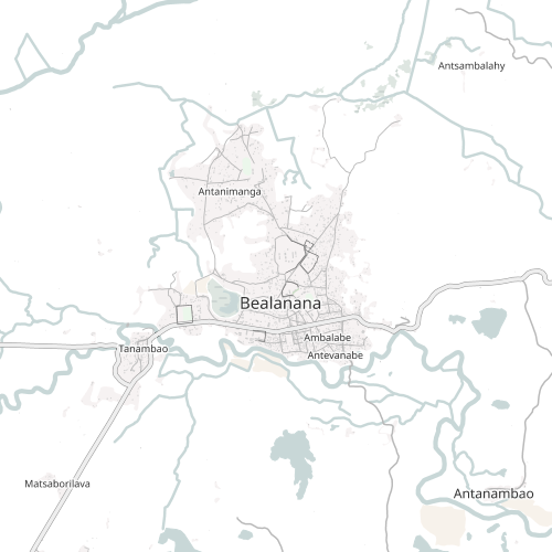
fond de plan OSM - Bealanana - Madagascar
Cette agrégation de couche regroupe différentes couches de données vectorielles (occupation du sol, hydrographie, réseau routier, POI, etc.) contenues dans la base de données géographiques libre OpenStreetMap sur la zone de Bealanana à Madagascar. Elle est mis à jour quotidiennement via imposm à partir des fichiers .pbf de GeoFabrik.
Simple
-
Date (Publication)Date (Publication)Date (Publication)
- 2022-04-11
-
Date (Creation)Date (Creation)Date (Création)
-
Presentation formPresentation formForme de la présentation
-
Digital documentDigital documentDocument numérique
-
StatusStatusEtat
-
CompletedCompletedFinalisé
- Point of contact
-
Organisation name Individual name Electronic mail address Role Les Libres Géographes
Les Libres Géographes
Séverin Ménard
Séverin Ménard
Point of contactPoint of contactPoint de contactLes Libres Géographes
Les Libres Géographes
Nicolas Chavent
Nicolas Chavent
Point of contactPoint of contactPoint de contact
-
Maintenance and update frequencyMaintenance and update frequencyFréquence de mise à jour
-
DailyDailyJournalière
- Keywords
-
-
LLG
-
- Keywords
-
-
Les Libres Géographes
-
-
Continents, countries, sea regions of the world.
-
-
Madagascar
Madagascar
-
-
Rhyvière - Madagascar - Gret
-
-
Gret
-
Les Libres Géographes
-
OSM_Mg
-
LLg
-
Rhyvière
-
OSM
-
schéma d'aménagement
-
open data
-
Beandrarezona
-
Beanantsindra
-
Bealanana
-
-
INSPIRE themes
-
-
Bâtiments
Buildings
-
Hydrographie
Hydrography
-
Occupation des terres
Land cover
-
Services d'utilité publique et services publics
Utility and governmental services
-
Réseaux de transport
Transport networks
-
-
Access constraintsAccess constraintsContraintes d'accès
-
LicenseLicenseLicence
-
Use constraintsUse constraintsContraintes d'utilisation
-
LicenseLicenseLicence
-
Autres contraintes
-
ODbL
-
Spatial representation typeSpatial representation typeType de représentation spatiale
-
VectorVectorVecteur
-
LanguageLanguageLangue de la ressource
- Français
-
Topic categoryTopic categoryCatégorie ISO
-
-
FarmingFarmingAgriculture
-
HealthHealthSanté
-
EnvironmentEnvironmentEnvironnement
-
StructureStructureConstructions et ouvrages
-
TransportationTransportationInfrastructures de transport
-
Utilities communicationUtilities communicationTélécommunication, approvisionnement et énergie
-
Imagery base maps earth coverImagery base maps earth coverCarte de référence de la couverture terrestre
-
))
-
Reference system identifierReference system identifierNom du système de référence
- WGS 1984WGS 1984
- Distribution format
-
Name Version
- OnLine resource
-
Protocol Linkage Name OGC:WMS-1.3.0-http-get-map
https://ifl2.francophonelibre.org/geoserver/rhyviere2_osm_latest/wms? MG_Rhyviere_Bealanana_groupe_styles
-
Hierarchy levelHierarchy levelNiveau
-
DatasetDatasetJeu de données
Metadata
-
File identifierFile identifierIdentifiant de la fiche
- 4f29cbf2-d4ff-4894-9955-37646ad00644 XML
-
Metadata languageMetadata languageLangue
- Français
-
Character setCharacter setJeu de caractères
-
UTF8UTF8Utf8
-
Date stampDate stampDate des métadonnées
- 2025-03-14T19:20:16.179179636Z
- Metadata standard name
-
ISO 19115:2003/19139
- Metadata standard version
-
1.0
- Metadata author
-
Organisation name Individual name Electronic mail address Role Les Libres Géographes
Les Libres Géographes
Les Libres Géographes
Séverin Ménard
Séverin Ménard
Séverin Ménard
Point of contactPoint of contactPoint de contactLes Libres Géographes
Les Libres Géographes
Les Libres Géographes
Nicolas Chavent
Nicolas Chavent
Nicolas Chavent
Point of contactPoint of contactPoint de contact
- Other language
-
Language Character encoding MalagasyMalagasyMalgacheUTF8UTF8Utf8EnglishEnglishAnglaisUTF8UTF8Utf8FrenchFrenchFrançaisUTF8UTF8Utf8
Overviews
Spatial extent
Provided by
